A man exploring the underground environment
Searching for mineral deposits hidden under the vast desert


Searching for mineral deposits hidden under the vast desert
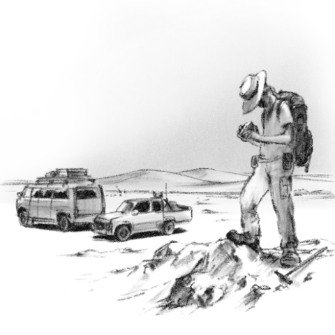
Our survey team was searching for a mineral containing useful elements in a desert of an Asian country. Relying on the satellite images and GPS, we drove a 4WD vehicle, making a cloud of dust. We got out of the car and thoroughly observed the ground surface, holding a hammer in hand. What kinds of rocks and minerals could be found? How would they be related to our target mineral? Would abundant mineral deposits exist beneath this desert? This was a region where there was no maintained infrastructure, such as electricity and roads. We slept in nomad tents and continued the survey.
This was a five-year joint project conducted by Japan and the government of the country. It was a natural resource exploration project to discover mineral deposits in the target area. The target area was approximately 120,000 ㎢, which is as large as the sum of Hokkaido, Aomori, Akita, and Iwate prefectures. In the three years before the field survey described above, airborne geophysical surveys and image analysis from earth observation satellites had narrowed the target area down to about 400㎢, which is 1/300th of the original area, or the size of Yokohama City. In order to conduct a drilling survey to confirm whether the minerals exist, it was necessary to select areas with a high probability of the existence of underground mineral deposits.
A "geological map" drawing the distribution of rocks and
faults on the earth's surface is essential for natural
resource exploration. At that time, we had a very abstract
geological map with a scale of 1:1 million from the host
country. In response, our survey team drew a detailed
geological map with a scale of 1:20000 on our own, using
satellite images and comparing the distribution of rocks and
faults obtained from the field survey.
Also, our survey
team drew the following mineral deposit model. The mineral
deposit model is a hypothesis about how a possible mineral
deposit was created and concentrated in this region. It goes
as follows:
・The mineral deposit was created in lakes and marshes 150-100
million years ago (Early Cretaceous) when the region had a
warm climate.
・The useful elements containing minerals were present in the
surroundings of lakes and marshes, got carried away by rivers,
and were quietly deposited on the bottom of the lakes.
・Stones, sand, and mud carried by rivers and deposited on top
of the useful elements generated pressure and heat,
concentrating the useful elements and producing minerals (this
process is called mineralization).
・Later, the heat from a volcano rising along faults promoted
mineralization and created mineral deposits.
Our hypothesis helps us to predict where the underground
minerals are in the geologic map. For example, geological
formations consisting mainly of stone and sand will be
excluded from the area of drilling surveys because they are
not an environment where useful elements can be quietly
deposited. On the other hand, geological formations consisting
of mud are an environment where useful elements can be quietly
deposited, and there is a possibility of accelerated
mineralization by the heat around faults. In other words, we
can expect minerals to exist there. After selecting areas, the
next step is to conduct a drilling survey. If our mineral
deposit model was right, we should be able to find minerals.
In a month, we drilled about 30 boreholes with a total drilled
depth of over 4,000 m.
Mineral concentrations were found in approximately 90% of the holes we surveyed. In addition, we conducted geophysical logging and confirmed the presence of high-grade minerals with ore grade analysis done after returning to Japan. We discovered a medium-sized mineral deposit with reserves of several hundred million tons based on the resource assessment.
The underground environment is diverse, consisting of rocks, faults, groundwater, magma, etc. There are no two places that are the same. This is linked to the fact that the surface environment, consisting of terrain, soil, vegetation, hydrology, climate, etc., varies all over the world. Therefore, it is possible to capture some evidence of the influence of the underground environment on the earth's surface. By utilizing survey methods, such as geophysical exploration and satellite image analysis, and knowledge and experience gained in various countries and regions, we can imagine the underground geological structure of a particular location without actually excavating the ground around the world. These surveys are essential for the development of underground natural resources, such as minerals and geothermal energy.