Natural Resources Survey
Geothermal Resources
The government of Japan declared that it would aim to achieve
"Carbon Neutrality" and reduce of greenhouse gass emissions to
zero by 2050. To achieve this goal in the electricity sector, we
are promoting the transition from fossil fuels (coal, oil, and
natural gas) to renewable energy (solar, wind, geothermal,
hydroelectric, etc.), which has low carbon dioxide emissions
during electricity generation.
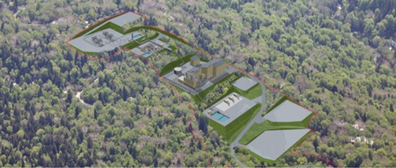
Geothermal power generation
not only produces clean energy but also is more stable baseload
energy source compared to solar and wind energy, which are easily
impacted by climates, because it utilizes vapor at high
temperatures (200-350°C) and boiling water that was heated up by
magma deep underground (1-3km below ground) near volcanos.
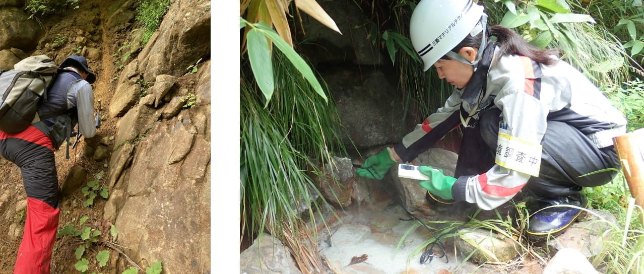
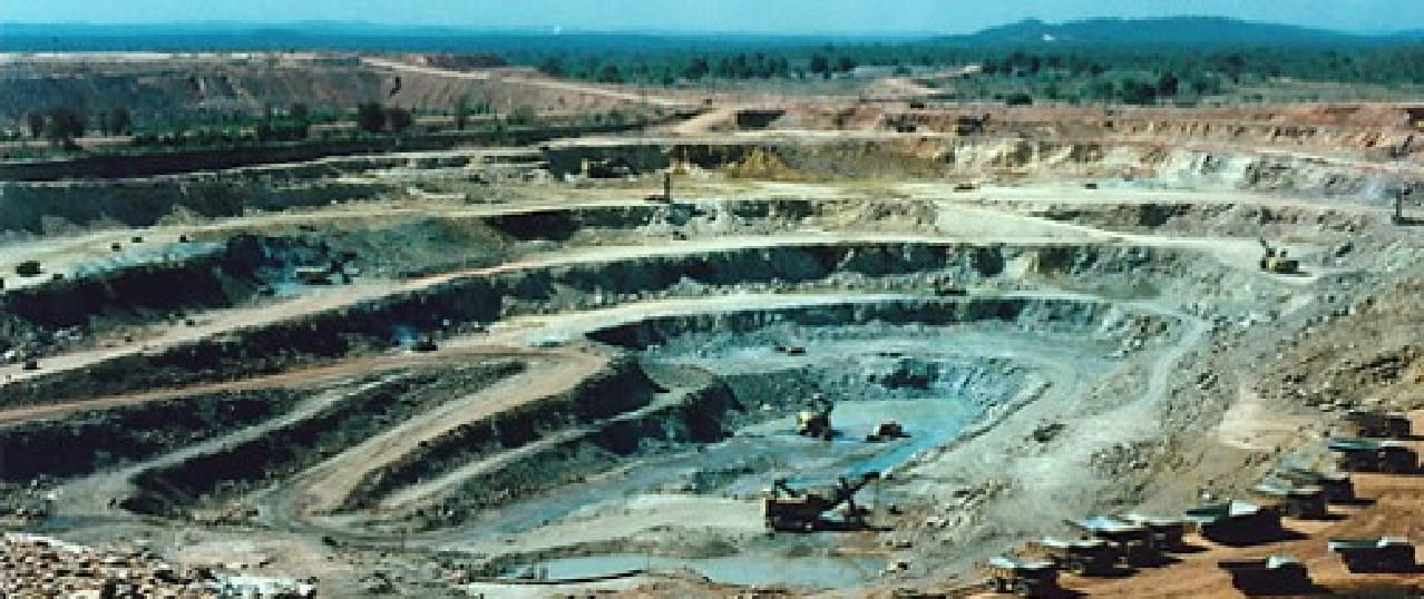
As a member of the group of companies of Mitsubishi Materials
Corporation, a geothermal electricity producer, we are performing
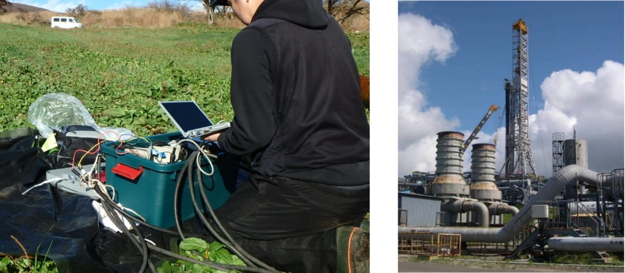
surficial geoscience surveys (satellite image analysis, geological and geochemical surveys, geophysical
survey) and deep
underground exploration and assessment (drilling survey, resources
assessment) to explore and discover undeveloped geothermal
resources.
As geothermal resources are generally found near volcanoes or hot
springs, we conduct environmental monitoring surveys to evaluate
the impact of development on the surrounding environment,
including hot springs.
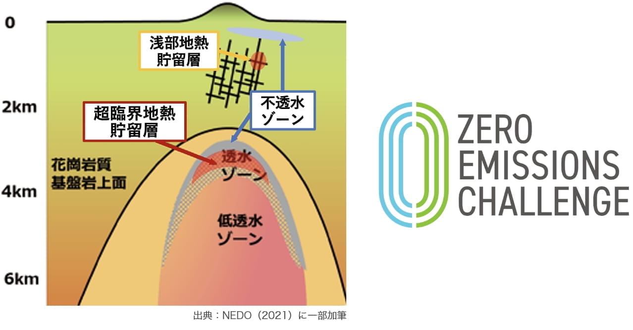
As a further effort to achieve carbon neutrality, research and
development on ”supercritical geothermal power generation” which
exist in deeper areas than conventional geothermal resources and
generate electricity using high-temperature vapor (400-600℃) and
boiling water, are in progress and being led by the government.
We were selected by Ministry of Economy, Trade and Industry, Japan
as a "Zero Emissions Challenge Company" for our participation in
the "Development of Methods of Geophysical Survey and Resource
Assessment," which focused on developing technology for
supercritical geothermal power generation, considered to be a
next-generation geothermal power generation technology.
Energy and Metallic Mineral Resources
Our consultation department uses technologies, such as surficial geoscience surveys and deep underground exploration and assessment, acquired in the mining industry as a foundation for the development of various energy and metallic mineral resources (copper, lead, zinc, gold, silver, platinum, palladium, minor metals, rare-earth elements, coal, uranium, petroleum, natural gas).
By applying the subterranean geoscience knowledge we acquired through natural resource development and survey, exploration, and assessment technologies, we participate in projects, such as national petroleum stockpiling (oil and LPG stockpiling in underground rock cavern tank system), geological disposal of high-level radioactive waste, and CCS (Carbon dioxide Capture and Storage). CCS is a technology to immobilize and store carbon dioxide captured at fossil fuel thermal power plants or industrial plants by injecting them into deep underground geological formations (rocks) with pressure and is essential to achieve the gradual reduction of fossil fuel use and carbon neutrality. We contribute to solving the challenges of creating a decarbonized society through geological disposals and CCS projects.
Measurement (Technology Development)
We are developing measurement technologies to visualize and 3D
model the deep underground geological environment (rocks,
minerals, faults, heat, and hydrology) in order to survey,
explore, and assess natural resources.
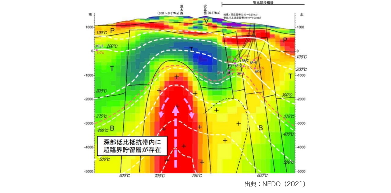
One achievement in technology development for supercritical
geothermal resources, which are considered a next-generation
geothermal energy production technology, was revealing a 3D figure
of magma, which is a supercritical geothermal heat source existing
approximately 5 km below ground by the magnetotelluric method, one
of exploration method in geophysics. We estimated the resource
amount to be 100MW (1/10 of a nuclear power plant).
We are applying the data processing and analysis technology for satellite image data, one of surficial geoscience survey methods, to develop the technology to recover 3D models of target objects using images taken by drones and regular cameras. With this technology we can also extract shape changes and the movement of target objects. The video below is an example of creating 3D models of a tunnel using a picture taken in the tunnel and the image processing and analysis method called SfM (Structure from Motion). We can observe geological formations (rocks) of different colors distributed inside tunnels as 3D models and extract various information on the geological environment as numerical values.